
GEOTECHNICAL MONITORING · TANZANIA
Geotechnical Monitoring Services in Tanzania | GEOUE
Engineering support for railways, mining, roads, bridges, dams, ports, slopes and major infrastructure across Tanzania.
Instrumentation, installation support, manual and automated monitoring, surveying, data analysis and engineering consultancy.
Tanzania project sectors
Geotechnical Monitoring for Tanzania’s Major Projects
GEOUE supports instrumentation and monitoring for infrastructure, mining, energy and urban development projects across Tanzania.
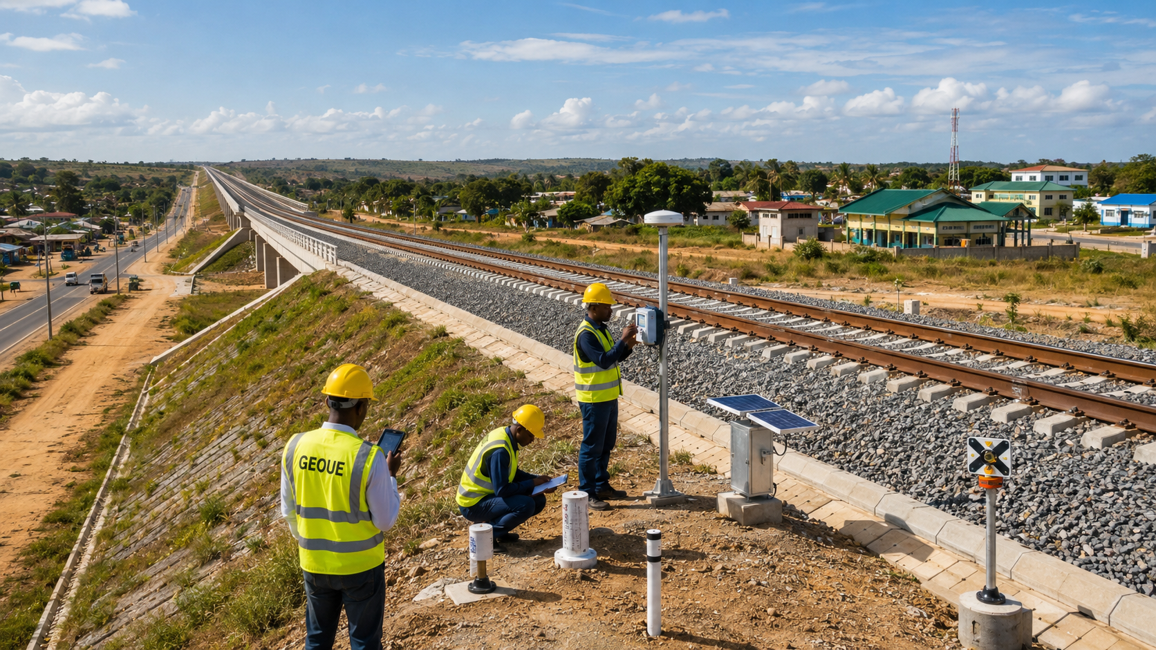
SGR & Rail Monitoring
Track settlement, deformation and structures on major rail corridors.
Mine & Tailings Monitoring
Monitor pits, slopes, tailings and ground movement at mine sites.
Road & Bridge Monitoring
Track settlement, slope movement and bridge response on road projects.
Dam & Hydropower Monitoring
Monitor dams, foundations and slopes for movement and pore pressure.
Port & Marine Monitoring
Track quay walls, reclaimed ground and settlement at port works.
Deep Excavation Monitoring
Track walls, ground, groundwater and nearby assets during excavation.
Slope & Embankment Monitoring
Track unstable slopes, cuttings and embankments for movement and risk.
Automated Monitoring
Use remote sensors, monitoring platforms and alerts for continuous monitoring.
GEOUE in Tanzania
GEOUE in Tanzania
GEOUE is a regional engineering brand used by GEOORIGIN ENGINEERING LIMITED (Hong Kong) for the Tanzania market. GEOUE/GEOORIGIN currently has no company, branch, representative office or permanent office in Tanzania. Engineering services and project delivery are supported through project-based cooperation with an established local engineering partner.
Contracting & Commercial Arrangements
Quotations, contracts and invoices are generally issued by GEOORIGIN ENGINEERING LIMITED (Hong Kong). The Hong Kong company can directly provide instrumentation supply, monitoring design, monitoring systems, data analysis, engineering consultancy and related technical services for projects in Tanzania. Local field activities are coordinated with project-based engineering resources in Tanzania.
Core services
Geotechnical Monitoring Services in Tanzania
GEOUE combines engineering-led planning, instrumentation and data review to support safe construction, asset performance and informed decisions across Tanzania.
Instrumentation & Monitoring
Geotechnical instrumentation and monitoring programmes configured around project risks and measurable outcomes.
Automated Monitoring
Remote sensors, dataloggers, survey systems and alerts for continuous or high-frequency observation.
Structural Monitoring
Monitor buildings, retaining walls, bridges and other structures for movement and response.
Survey Monitoring
Precise survey observations for deformation, settlement and three-dimensional movement.
Settlement Monitoring
Track vertical movement of ground, embankments, structures and reclaimed land.
Slope Monitoring
Measure movement, groundwater influence and changing conditions on slopes and cuttings.
Groundwater Monitoring
Monitor groundwater levels and pore-water pressure for excavation, slope and foundation risks.
Vibration Monitoring
Record construction and environmental vibration around sensitive assets and work sites.
Project-based field delivery
Local Field Delivery in Tanzania
GEOUE projects in Tanzania can be supported by an established local engineering partner engaged on a project-by-project basis. Local capabilities include instrumentation installation, manual monitoring, automated monitoring, surveying, soil investigation, geophysical survey and associated field coordination.
Instrument Installation
Install, commission and check instruments against approved project requirements.
Manual Monitoring
Collect scheduled field readings and maintain clear observation records.
Automated Monitoring
Support remote systems, sensors, dataloggers and planned alert workflows.
Surveying
Coordinate survey observations for settlement, deformation and asset response.
Soil Investigation
Support ground investigation activities aligned with monitoring and engineering needs.
Geophysical Survey
Coordinate project-based geophysical survey and associated field delivery.
Technology and equipment
Monitoring Instruments & Systems
Equipment is selected according to ground conditions, structural behaviour, required accuracy, monitoring frequency and project risk.
Inclinometers
Measure lateral ground and structural movement.
Piezometers
Monitor groundwater and pore-water pressure.
Settlement Points
Track vertical movement of ground and structures.
Survey Prisms
Support precise three-dimensional deformation monitoring.
Tiltmeters
Measure rotation and gradual change in structures.
Crack Meters
Track changes in cracks and movement across joints.
Vibration Monitors
Record construction and environmental vibration.
Automatic Total Stations
Enable remote, high-frequency survey monitoring.
Dataloggers
Collect and transmit readings from connected instruments.
Remote Monitoring Systems
Connect data, trends and alerts for review.
Delivery framework
Our Approach
- 01
Plan
Set risks, baselines and trigger levels.
- 02
Local
Coordinate local access, manpower and delivery.
- 03
Install
Install and verify instruments to approved plans.
- 04
Monitor
Combine manual readings with automated monitoring.
- 05
Review
Check trends, anomalies and trigger exceedances.
- 06
Respond
Escalate alerts and support rapid field response.
Team experience
Selected International Team Experience
The references below represent experience of GEOUE team members from previous and international assignments. They are not presented as projects completed by GEOUE or GEOORIGIN in Tanzania.
Rail & Major Infrastructure
Team experience includes Singapore LTA North-South Corridor geotechnical monitoring and monitoring works associated with CCL, EWL and DTL MRT environments.
Deep Excavation & Tunnels
Experience includes instrumentation and monitoring for deep excavations, underground works, tunnels, groundwater control and associated structures.
Buildings & Heritage
Team experience includes Singapore HDB residential monitoring assignments and heritage monitoring associated with Singapore Kampong Glam.
Post-Earthquake Monitoring
Experience includes China Geological Survey Wenchuan post-earthquake monitoring (2008–2010) and Great East Japan Earthquake building monitoring (2011–2013).
Instrumentation & Automation
Experience covers geotechnical instrumentation, structural monitoring, vibration monitoring, surveying, automated monitoring and engineering data review.
General team experience also spans Metro / Rail, Deep Excavation, Tunnel, Building / Structural, Road / Bridge, Dewatering, Vibration, Geotechnical Instrumentation and Automated Monitoring.
Engineering-led support
Why GEOUE for Tanzania Projects?
Engineering-Led
Monitoring strategies developed around engineering risks and project requirements.
Integrated Delivery
Instrumentation, monitoring, field delivery, data review and consultancy can be coordinated under one technical framework.
International Experience
Team experience spans major rail, tunnel, excavation, building and infrastructure monitoring environments.
Technology Ready
Manual monitoring can be combined with automated monitoring, digital platforms and advanced data workflows.
Practical answers
Geotechnical Monitoring in Tanzania – FAQ
Does GEOUE provide geotechnical monitoring services in Tanzania?
Yes. GEOUE supports instrumentation, monitoring and related engineering services for projects in Tanzania through GEOORIGIN ENGINEERING LIMITED (Hong Kong), with local field delivery supported by project-based engineering resources.
Does GEOUE have an office in Tanzania?
No. GEOUE/GEOORIGIN currently has no company, branch, representative office or permanent office in Tanzania.
Who issues quotations and contracts for Tanzania projects?
Quotations, contracts and invoices are generally issued by GEOORIGIN ENGINEERING LIMITED (Hong Kong).
Can GEOUE provide local installation in Tanzania?
Yes. Instrument installation and associated field activities can be supported through an established local engineering partner on a project-by-project basis.
What field services are available in Tanzania?
Available support includes instrumentation installation, manual and automated monitoring, surveying, soil investigation and geophysical survey.
Can GEOUE provide both equipment and engineering services?
Yes. Project scopes can combine instrumentation supply, monitoring design, field installation support, data analysis, monitoring systems and engineering consultancy.
Does GEOUE have completed projects in Tanzania?
GEOUE/GEOORIGIN does not currently claim completed Tanzania project references. Relevant international team experience and local delivery capabilities are presented separately.
How can contractors invite GEOUE to quote?
Main contractors, specialist contractors, consultants, developers and asset owners can contact GEOUE for RFQs, tender invitations and project discussions.
RFQ · Tender · Engineering enquiry
Planning a Monitoring Project in Tanzania?
Send GEOUE your project scope, BOQ, specifications or tender documents for engineering review and quotation.